Discussion
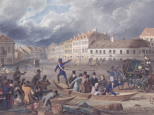
For the vast majority of Vienna’s history, the adjacent Danube was little more than a slow-moving marshland that periodically flooded, causing the course of the river to shift and changing land into water and water into land. For this reason, little construction occurred in the river’s broad floodplain. This did not mean, however, that those in urban areas away from the floodplain were safe. Indeed, Vienna (and much of Central Europe) suffered a thousand-year-flood in August 1501, and particularly devastating floods also hit the city in 1830 and 1862 (Mitková et al. 2016, 9; Chovanec et al. 2000, 117).
Despite these isolated incidents, avoiding construction in the floodplain worked for the residents overall for many years. With industrialization and rapid population growth, however, the Danube became a new challenge. The river still abutted the old city, separating it from several of its suburbs as effectively as the old walls did. In May 1859, for instance, the Wiener Zeitung reported that negotiations were underway among the local council to replace the footbridge that spanned the Vienna River (a smaller tributary of the larger Danube) with a larger bridge. The municipal magistrate argued that the best location from the bridge would be at the mouth of the Schleifmühlgasse (directly to the South of the inner city) because it would allow for the free flow of traffic in all directions (Wiener Zeitung, May 13, 1859).
In addition to constraining traffic, many in the city began to see the floodplain as prime real estate going largely untapped. In 1800, Vienna had a population of only 270,000, which increased to 726,000 by 1880, 1.36 million by 1890, and finally peaked in 1910 at just over 2 million (Fassman and Münz 1996, 166; City of Vienna 2020b). A solution was devised in the form of a plan to regulate the flow and course of the river itself. The regulation of the Danube provided the opportunity not only to reduce the risk of flooding, but also to open up land to construction and settlement, as well as a means to demonstrate scientific advancement and increase national prestige. The 1873 World Exhibition in Vienna was the city’s opportunity to present its achievements to the world, and the uncontested control over the Danube would be an undeniable demonstration of that power (Stamper 2004, 229-231).
Construction on the Danube River project officially began on May 14, 1870, with the celebratory opening of the project by the Emperor and assembled notables. The daily newspaper Wiener Zeitung reported that “If the expansion of the city and the water supply meet the needs of increasing the number of dwellings and the public health, then the means of public prosperity is greatly increased by the regulation of the Danube, by which the property of a large part of the population is protected” (Wiener Zeitung, May 15, 1870). Over the course of the next five years, large crews diverted the course of the river while a large, mostly straight channel, 280 meters across, was dug. When the channel was completed in 1875, the meandering tributaries of the past millennia were replaced by a single aquatic superhighway (Yedan 2016). The official opening of the new Danube was met with significant fanfare, with the newspaper proclaiming that “Vienna and its surroundings are now protected against recurring disastrous floods as far as human foresight extends,” and that “five great and solid bridges cross the river, and the connection between the south and north of the monarchy, (which is threatened by ice every year), is now permanently secured” (Wiener Zeitung, May 15, 1875).

Plan for the Vienna Danube Regulation Project. Hinkel, Raimund. Wien XXI. Floridsdorf. Das Heimatbuch. Wien: 1994. Wikipedia.
This was not the only strategy employed by the city. One unique tool used to control flooding was the Schwimmtor or “swimming gate,” a device unique to Vienna used beginning in 1873. This was essentially a large metal barge that would float in the river during times of elevated water flow. As it would be attached to the banks of the river, it would act as a break that would slow the speed of the flowing water significantly, although it was not designed to stop it altogether (Czerny 2010, 17).
Despite the positive prognostications by the Wiener Zeitung and the implementation of additional flood measures, flooding continued to plague the city. In fact, Vienna was hit with two major floods in 1897 and 1899 that demonstrated the limits of the existing system. Even the most resilient flood control systems are only designed to withstand a certain level of water flow, and the two floods at the end of the nineteenth century, at around 10,000 cubic meters per second, exceeded what the original flood regulation measures could handle (Blöschl et al. 2015, 331). Following another major flood in 1954, the city government recognized the need for improvements to the century-old flood regulation system and began to implement an improvement program. In 1972, construction began on the New Danube Flood Relief Channel, an additional waterway running parallel to the original Danube channel constructed a century before. Construction on the new waterway lasted until 1988, and when it was completed, the New Danube Channel ran for approximately thirteen miles. The new channel does not flow freely as simply another arm of the river, but rather is separated from the old channel by a set of locks that are only opened in times of flooding. In this manner it acts as a relief valve for the river (Chovanec 2000, 177).


